
Searching a Mansfield Street Directory
A Mansfield address search works best as a sequence of records rather than a single name search. Start with the situs address in the Mansfield parcel map and note its PID or parcel number. That gives the property key, the assessed owner, the Mansfield tax-mailing address, and the map context. The owner mailing field can point outside town, so it shows where tax notices go, not who is present at the property. From that point, a deed index can confirm a recorded party and a dated instrument, while library material can provide historical address evidence.
- Find the address in Mansfield AxisGIS, then save the Mansfield situs address, PID, parcel number, and owner and mailing fields separately.
- Pan and zoom along the same Mansfield street, clicking parcels one at a time. Parcel boundaries and map layers help distinguish a parcel from a public way, common land, or another mapped feature.
- Search the Northern Bristol Registry for a Mansfield street over a narrow date range. Keep the document type, street number if used, street name, and town aligned with the record being sought.
- Repeat each promising Mansfield result through the grantor and grantee name controls. That step can reveal instruments with no useful street field.
- For an earlier Mansfield address trail, compare the library Street Listings and the 1918 street and inhabitant sections rather than treating a deed party as a complete household.
That order makes the Mansfield street directory useful for civic curiosity, family history, and Mansfield property research without blending ownership, mailing, and historical occupant evidence into one claim.
Mansfield Street Parcel Fields
The AxisGIS public configuration exposes the fields that matter for a street-by-street search. Its public assessment setup names the owner, co-owner, physical property address, mailing address lines, city, state, ZIP, PID, and parcel number. The inspected configuration identifies its assessment date as 2024. It does not verify every live search behavior, result limit, or printed card field, so use the viewer as a live map and confirm anything consequential with the Assessor.
| AxisGIS field | Use in a street search | Format or limit |
|---|---|---|
| OwnerName | Mansfield assessed owner name | Public configuration field; live matching behavior was not captured |
| CoOwnerName | Additional Mansfield assessed owner | Exposed in configuration |
| PropertyAddress | Situs or physical parcel location | Address key for the street directory |
| OwnerAddress and OwnerAddress2 | Tax-notice destination | Keep distinct from situs |
| OwnerCity, OwnerState, OwnerZip | Mailing-location context | Not evidence of residence at the parcel |
| PID | Mansfield parcel identifier | Use to bridge map and municipal records |
| ParcelNumber | Mansfield parcel key | Configuration shows both 000-000 and 000-000-000 formats |
| Map parcel click | Property-detail route | Live map interaction is required |
Map layers include parcel and property information alongside zoning, contours, wetlands, flood, open-space, soils, and historic-inventory layers. They provide location context, not a resident list. The Mansfield Assessor is the local counter for the underlying parcel and assessment questions.
Mansfield Parcel Format Check
One Mansfield map quirk deserves a pause before a failed search becomes a false conclusion. The AxisGIS configuration uses a parcel pattern of 000-000 in one area and 000-000-000 in report and search formatting. The research did not capture the live entry rule, so try the displayed style in the current Mansfield viewer and preserve the PID beside it. A formatted Mansfield parcel key is more durable than a street label when a tract is divided, merged, or described by plan.
Use a parcel click to browse a street segment. Save each key before moving on. The live configuration supports map layers, but the exact select, measure, export, and print controls were not verified. Note: A parcel key connects records, but it does not establish a complete household or a current person at the address.
Mansfield Street Records Coverage
Address-keyed Mansfield sources have different purposes and different gaps. Mansfield property information anchors a parcel. Registry material anchors a recorded instrument. Permit and municipal-request routes can date an existing record. Library sources may connect a past address to an occupant. The table keeps those functions separate so a Mansfield street directory result is not asked to prove more than its source can support.
| Address record | Key used | What it can establish | Access route |
|---|---|---|---|
| Mansfield AxisGIS and Assessor | Situs, PID, parcel number, owner | Parcel context and owner versus mailing distinction | Public map and Assessor counter |
| Recorded Land Street | Street, date, town, document type | Instruments carrying street fields | Public Registry portal, with incomplete street coverage |
| Recorded Land Name | Grantor, grantee, date, town, document type | Recorded-party and title-chain clues | Portal from 1735 to current date; copies are separate |
| Land Court | Certificate, document, date, town | Registered Land instruments | Portal from 1903 to current date |
| Mansfield PermitEyes | Address and permit number | Construction or inspection evidence and named permit fields | Public view linked by the town; live result fields not captured |
| Mansfield town records request | Department, date, record description | Existing municipal address records | Form, mail, email, fax, or counter |
| Mansfield Street Listings | Street, number, year | Historical address-to-occupant continuity | Certuse Room, 1870 to 2021 with missing years |
| 1918 directory street section | Street and cross-street | Regional historical address-to-name clues | Public scan; confirm Mansfield within its regional scope |
The Mansfield public-records request form is the fallback for an existing Mansfield municipal record that is not online. It accepts in-person, mail, fax, and email requests, asks for a reasonable description, and says the town responds within ten days. A request does not require the town to create a new combined address list.
Mansfield Street Inquiry Limits
The Northern Bristol Recorded Land Street Inquiry is a useful first Mansfield pass, but it is deliberately narrow. It requires Start Date, End Date, Doc Type, Street Name, and Town. Street Number is optional. Its own warning says that not all documents have a street number or street name, so a complete search must be performed by name. Use a short interval when possible, then widen only after recording the first result set.
The next pass belongs in the Recorded Land name inquiry. Its party controls let the researcher choose Grantors, Grantees, or Both. A grantor is generally the party conveying an interest; a grantee is generally the receiving party. Repeating both roles is the practical Mansfield fallback for a deed, plan, easement, or other instrument that does not carry the street data entered in the first search.
The Registry Street Inquiry displays the number and street-name fields that make its limitation visible.
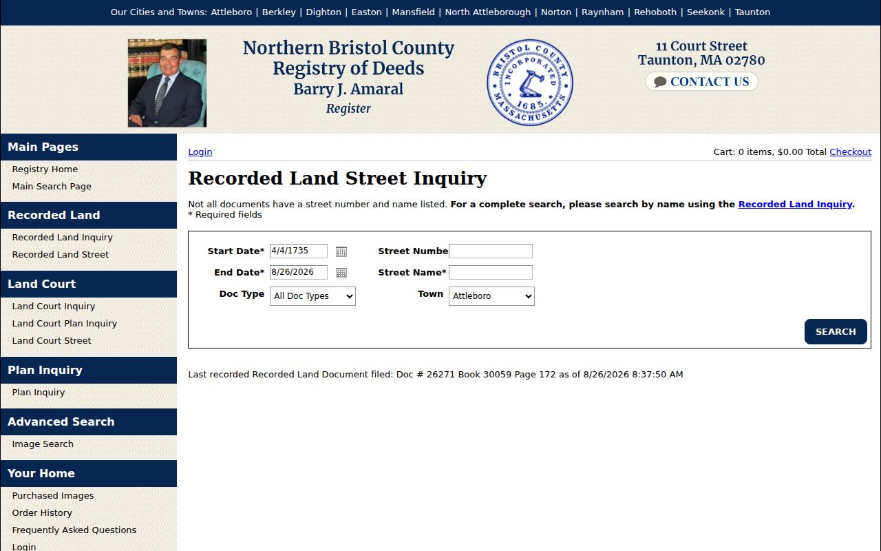
The screen reinforces why a street search is only one part of the Mansfield record chain. The required date, document-type, street-name, and town fields must be paired with the Registry's name search when the address indexing is incomplete.
Why Taunton Holds Mansfield Deeds
Mansfield is in Bristol County, while Taunton is the county seat and the location of the Northern Bristol County Registry of Deeds. The Registry serves Mansfield as well as Attleboro, Berkley, Dighton, Easton, North Attleboro, Norton, Raynham, Rehoboth, Seekonk, and Taunton. That records geography explains why a Mansfield street directory trail leaves town for recorded instruments but returns to local offices and library collections for other evidence.
Recorded Land index data is displayed from April 4, 1735, beginning with Book 24, through the current date. Land Court indexing begins August 5, 1903. The portal notes that some earlier Mansfield records may be available but are not verified, and it separates online index or image access from official or certified copies obtained through the Registry. Note: The long Mansfield Recorded Land run is a finding aid, not proof that every older image or instrument is equally available online.
Mansfield Street Permit Evidence
Address-dated permit material can add a construction or inspection event to a Mansfield street search. The town's Building Permits page links the PermitEyes public view. The inspected municipal form identifies permit number, premises owner, owner contact, property street address and subdivision lot, installer contact, installation description, inspection type and date, and signature. Those fields describe a permit process, not an occupancy list.
PermitEyes is best used after the Mansfield parcel and deed records have fixed the address and time window. The public route was confirmed, but the live filters, result columns, and earliest online coverage were not captured. A no-result screen therefore does not show that no construction or inspection record exists. The Mansfield Building Department or a narrowly described records request is the next handoff.
Mansfield PermitEyes public view provides the address-focused route linked by the town.
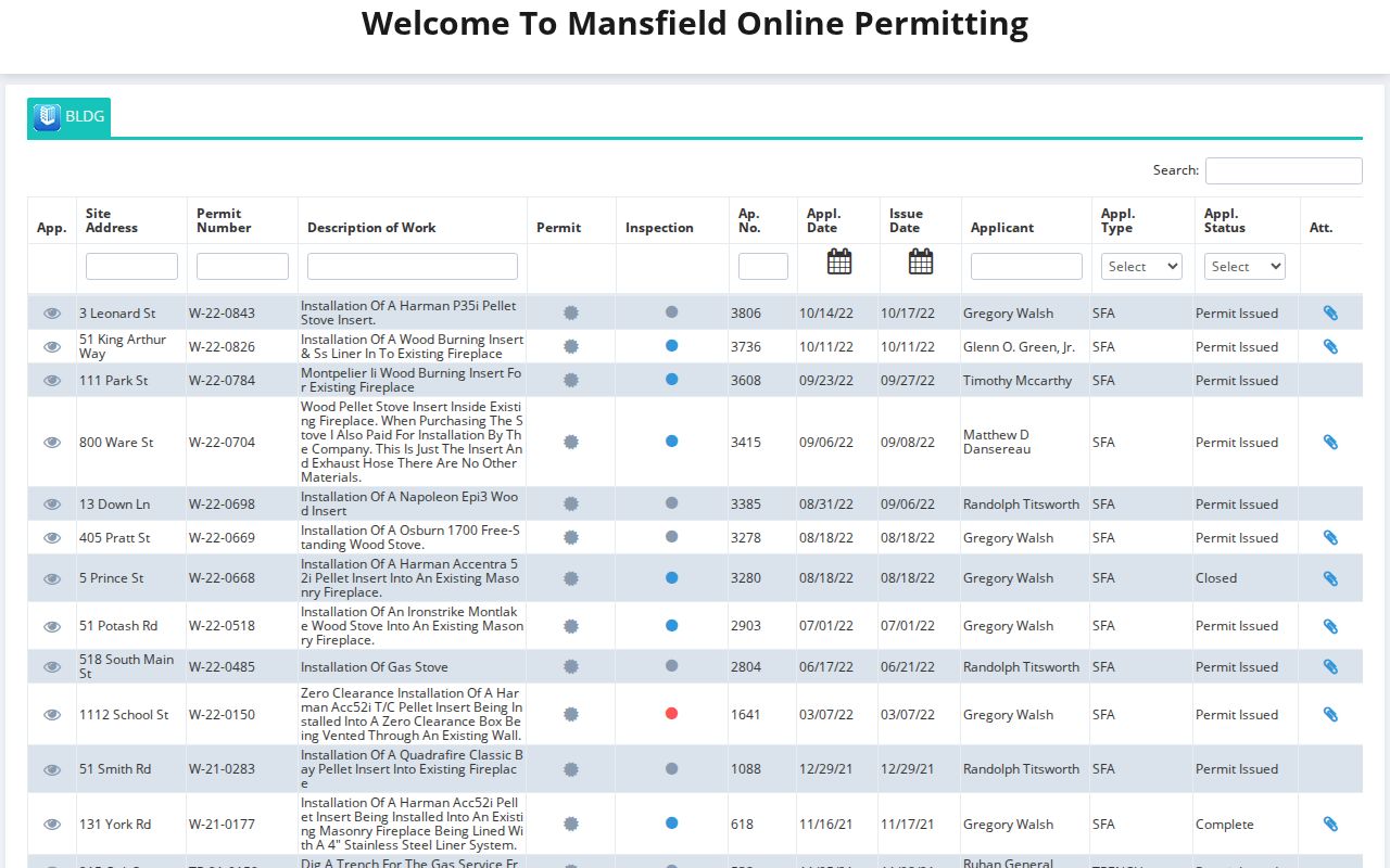
This public-view screen belongs beside deed and parcel research because permits can date physical changes while leaving household questions unanswered.
Mansfield Street Address Terms
Several labels can look interchangeable in a Mansfield street directory, but they are not. Keeping them distinct prevents a mailing destination, a plan reference, or an old occupant entry from becoming a claim about present ownership. The field names below match the keys that recur across Mansfield's map, Registry, and historical sources.
- Parcel
- A mapped unit of property identified by a PID or parcel number. It links a location to assessment and legal-record research.
- Situs address
- The physical location of a parcel or building. It is different from the assessed owner's tax-mailing address.
- Plat or plan
- A recorded plan showing lots, boundaries, and related geometry. It can help when a house number is missing or has changed.
- Criss-cross directory
- An address-first directory arrangement. Mansfield's publicly identified direct address source is its Street Listings, while an unbroken reverse-directory shelf run was not located.
Mansfield legal descriptions add another key: book and page, plan, lot, bounds, easements, and, where applicable, a Registered Land certificate relationship. They often survive an address change more reliably than a human-readable number.
Mansfield Street Numbering
Mansfield's numbering bylaw sets numbers sequentially from one end of a street to the other, with even numbers on one side and odd numbers on the other. It also describes building-letter and three-digit unit conventions, including basement 0XX and first-floor 1XX forms. The Assessor assigns numbers from the front-door location and consults Police and Fire for corner or conflict cases. Open land can receive a number that allows later subdivision.
Mansfield numbers may be changed after written certified notice, a thirty-day posting period, and E911 enforcement. No official Mansfield historic conversion table or dated townwide renumbering project was located. When an old number does not match the current address, compare cross-streets, abutters, a plan or legal description, the Sanborn sheet, and nearby directory entries. The 1918 street section also gives direction and landmark context, which can bridge a Mansfield number gap without inventing a renumbering date.
Mansfield Street Listings
The Certuse Room holds Mansfield Street Listings from 1870 through 2021, with missing years. They are the strongest documented local address-to-occupant run. Historical House files are also arranged by street address, though they are not presented as a complete parcel history. For the wider collection context and the 1918 directory's entry structure, see the Mansfield City Directories.
The 1918 A.E. Foss regional volume begins its Street Directory with a street and cross-street or direction, then supplies name, address, and role clues in the Inhabitants section. Its coverage includes Mansfield, Norton, and Raynham, so a name must be tied back to the Mansfield street, town context, or neighboring entry. A Mansfield address listing may identify an earlier occupant, but it does not establish title or a current household.
Mansfield Street Directory Limits
A Mansfield street directory cannot show a complete household, every non-owner occupant, private utility or delivery information, protected voter data, or RMV personal information. The Massachusetts voter status tool is an individual's own-status check, not a public street-browse roll. Address Confidentiality Program participants use substitute addresses, and court guidance can withhold a plaintiff's residential details. A blank field can reflect those limits, a missing year, an unindexed street field, or a record that never belonged in that source.
Lawful personal use. Mansfield address records support personal research, property history, and family-history questions. Do not use them to stalk, harass, or repeatedly contact any person.
Use the record holder to verify an important finding. The Massachusetts Address Confidentiality Program, voter rules, court protections, and motor-vehicle privacy limits are access boundaries, not gaps to work around.