
Mansfield Previous Residents Sources
A backward Mansfield address history needs sources that overlap by era. Mansfield deeds supply a title trail. Street listings and a regional directory can supply dated occupant clues. Census schedules add a historical household layer, while news, maps, permits, and local files can explain a gap or a physical change. The oldest source is not automatically the best starting point. Begin with the most recent Mansfield record that clearly identifies the parcel, then move to the source that reaches the preceding period.
| Source | Years it covers | Where held | What it shows |
|---|---|---|---|
| Northern Bristol Mansfield Recorded Land | 4/4/1735 to current date; earlier material may exist but is unverified | Registry portal and Taunton office | Recorded parties, instruments, dates, town, book or page, and image path |
| Mansfield Land Court index | 8/5/1903 to current date | Registry portal | Registered Land instruments and certificate-related routes |
| Mansfield Street Listings | 1870 to 2021, with missing years | Mansfield Public Library Certuse Room | Historical Mansfield address-to-occupant continuity |
| Mansfield A.E. Foss regional directory | 1918 scan | Internet Archive and established metadata | Street and inhabitant entries across Mansfield, Norton, and Raynham |
| Mansfield federal census context | 1790 to 1950, released under the 72-year rule | NARA, FamilySearch, and library access | Historical household and address context, depending on the schedule |
| Mansfield News | 1873 to 1976 public online; 1977 to 2022 library-only | Library and newspaper archive | Obituaries, notices, civic events, and Mansfield address clues |
| Mansfield Sanborn map | June 1892, five sheets | Library of Congress | Building footprint, use, street geometry, and period context |
| Mansfield PermitEyes | Public online coverage not stated | Town public view and Building Department | Construction and inspection evidence tied to an address |
These Mansfield sources do not all prove the same thing. A previous Mansfield resident may appear in a Street Listing or census while a deed names a title party. Record the Mansfield source date and role before connecting the two. Note: A missing year in the local Street Listings should be marked as a gap, not filled with an assumption from a later or earlier entry.
Mansfield Parcel Before the Past
Start the Mansfield past-residents trail in Mansfield AxisGIS. Save the PropertyAddress, PID, parcel number, assessed owner, and owner mailing address. The mailing field can be outside Mansfield and only shows where tax notices are sent. Keep it separate from the Mansfield situs address, which identifies the physical parcel. That distinction is important before searching an old name, because the Mansfield deed description and current street number can point to the same property in different ways.
The Mansfield AxisGIS configuration names OwnerName, CoOwnerName, PropertyAddress, OwnerAddress, OwnerAddress2, OwnerCity, OwnerState, OwnerZip, PID, and ParcelNumber. It shows an assessment-current date of 2024. Its parcel format appears as both 000-000 and 000-000-000 in different configuration areas, so verify the live Mansfield format instead of discarding a parcel search too quickly. Mansfield map layers and parcel clicks add geometry that can help compare a plan, an abutter, or an old street description.
Mansfield Deed Chain Steps
The Northern Bristol Registry is the core source for tracing Mansfield prior title parties. Begin with the current Mansfield assessed owner, then use the Recorded Land Inquiry to search that owner as a grantee with the appropriate date range and document type. The instrument usually supplies the next bridge: a grantor, a recording date, a book and page or document placement, and a legal description. Search the named grantor as a grantee in the earlier transaction, then repeat with the same Mansfield parcel notes beside each result.
- Preserve the current Mansfield situs address, PID, parcel number, owner name, mailing address, and map context from AxisGIS.
- Search the current Mansfield owner as a grantee in Recorded Land, starting with a deed and adding other relevant instrument types only when the chain calls for them.
- Open the Mansfield image route or request an official copy, then record grantor, grantee, recording date, book or page, legal description, and prior-instrument references.
- Search the Mansfield grantor as a grantee to locate the earlier purchase. If a record names a trust, estate, corporation, or trustee, search the exact indexed entity and the individual names shown.
- Repeat backward while comparing each legal description and plan to the Mansfield GIS parcel. Flag a subdivision, merger, easement, or number change before treating it as the same address.
- Use a Mansfield Land Court certificate or document route when the parcel is Registered Land. Do not substitute a Recorded Land book and page for a certificate number.
- Grantor and grantee
- The grantor is generally the party conveying an interest, and the grantee is generally the party receiving it. The Mansfield Registry role controls help separate those searches.
- Chain of title
- A dated sequence of recorded transfers or related instruments linked through parties and a consistent legal description. It is not a list of every person who lived at the address.
- Legal description
- The Mansfield record's parcel language, such as lot, bounds, plan, book and page, easement, or certificate reference. It can remain useful when an address number changes.
Use the Registry's Advanced Image Search when a known book and page, plan, Land Court document, or certificate number needs a direct image route.
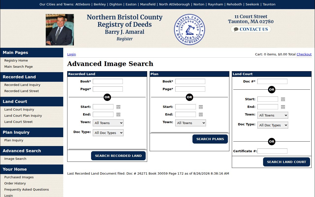
The image-search options support a careful backward trail because a deed reference, a plan, and a Land Court certificate do not use the same retrieval path.
Mansfield Recorded Land Depth
Recorded Land index data for the Northern Bristol Registry is displayed from April 4, 1735, beginning with Book 24, through the current date. The Registry says some earlier Mansfield records may be available but are not verified. Land Court indexing begins August 5, 1903. Both dates are powerful for a Mansfield house-history search, but the online index, a scanned image, and an official or certified copy are different levels of access. Confirm an important Mansfield instrument with the Registry rather than relying on an index entry alone.
The Registry Street Inquiry can help when a Mansfield house number, street name, town, document type, and narrow date interval are known. Its warning is central to any backward search: not every document has a street number or name. Repeat the effort with the grantor and grantee controls, then compare the legal description and plan. That extra Mansfield pass is an insider practice, not redundant searching. It catches instruments indexed by parties rather than by the modern address.
Mansfield Previous Residents Process
Mansfield ownership is only one layer of who lived here before. The household trail begins after the parcel and deed chain have identified a reliable Mansfield time window. Mansfield's Street Listings provide the strongest documented local address-to-occupant run, but missing years are real. Pair the street and number with the nearest directory or census period, then use notices, cemetery material, or probate files only as dated supporting evidence. A person in a historical Mansfield listing may have had no title interest in the property.
- Write the exact Mansfield address, cross-street, PID, and legal-description clues in one timeline.
- Check the Mansfield Street Listings for the target year and adjacent available years, preserving initials, spelling, and any address variation.
- Read the 1918 Mansfield directory's street section before its inhabitant section. Its directions and cross-streets can catch an old number or OCR miss.
- Pair the Mansfield address-year with the nearest available federal census year. The public census run reaches 1950 under the 72-year release rule.
- Search Mansfield News for an abrupt transition, move, death, civic notice, or street reference that can explain the timing.
- Return to the Mansfield deed chain to see whether a sale, estate, plan, or other recorded event fits the same period.
The Mansfield City Directories section supplies the collection-level detail behind the Street Listings and the 1918 volume. Here, those materials are used as time-stamped steps in one address history rather than as a substitute for parcel continuity.
Mansfield House File Limits
The Certuse Room holds Historical House files arranged by street address, along with Street Listings, yearbooks, town reports, photographs, cemetery material, and local-history resources. The public holdings page does not say every old building has a file or provide a complete year index. A precise request with the street, number, former name, approximate period, and record type is more useful than a broad request for everyone associated with an address.
The Mansfield History Center can also be a local handoff. Its collection includes photographs, newspapers, artifacts, books, and publications, but it says holdings are largely unorganized and research is handled by email or appointment. Its Copeland House location is at 53 Rumford Avenue and is open Saturdays from 10 a.m. to noon, free but not accessible. The old town hall burned in 1970, so reports, house files, and newspaper material now sit across town pages, library holdings, and local-history collections. Note: An unorganized local collection can produce a useful lead, but it is not a complete searchable index.
Mansfield Address Numbering Gap
Mansfield numbers streets sequentially from one end to the other, with even numbers on one side and odd numbers on the other. Its bylaw also covers building-letter and three-digit unit conventions and gives the Assessor a role in assigning numbers from the front-door location. Numbers may change after certified written notice, a thirty-day posting period, and E911 enforcement. Those rules explain why an old address should be tested against parcel and map evidence before it is carried back through time.
No official historical renumbering or street-conversion table was located. That is a real limit, not permission to guess a conversion. Bridge a doubtful number with cross-streets, nearby parcels, an abutter, a plan or legal description, the Sanborn sheet, and adjacent directory entries. The 1918 street section describes directions and landmarks, so it can help make a cautious connection between an older number and a present parcel.
Mansfield Past Residents Clues
The June 1892 Mansfield Sanborn map has five sheets that show building footprint, use, street geometry, and period context. It cannot name a household, but it can clarify whether a structure or lot configuration fits the address history. Compare the sheet with a plan, cross-street language, and the current parcel map. This is especially helpful where a deed uses bounds or a historical directory gives a direction instead of a modern number.
Mansfield News offers another dated layer: 1873 to 1976 is public online, while 1977 to 2022 is library-only. The library says its 1873 to 1927 holdings were digitized with a Mass Humanities grant. Obituaries, society notices, civic events, and address clues can help explain a change in the timeline, but none should be used alone to establish the full history of an address.
The 1918 Mansfield, Norton, and Raynham directory scan supplies the regional street and inhabitant context for a single era.

The scan needs town-level checking because its entries span Mansfield, Norton, and Raynham. A street, cross-street, or neighboring entry can supply the needed Mansfield connection.
Mansfield Previous Residents Boundaries
Previous-residents research has firm boundaries. A deed can identify a recorded party, a directory or census can provide historical household evidence, and a permit can date a physical event. None of those sources supplies a complete present-day household record. Protected voter information, Address Confidentiality Program addresses, RMV personal data, private utility or delivery information, and court-protected residential details are not gaps to overcome. They are protected categories.
Lawful personal use. Use Mansfield address history for family history, house history, and personal research. Never use a historical trail to harass, track, or repeatedly contact a living person.
For a record that matters, verify it with the custodian. The Registry, library, Assessor, Town Clerk, Probate Court, and historical organizations hold different pieces of the Mansfield trail. A careful negative result may mean a missing year, an unindexed street field, a regional entry outside Mansfield, or a protected record.